September sees above-average rainfall due to massive summer storm

Posted Oct 6, 2025 07:10:01 AM.
Last Updated Oct 6, 2025 11:19:17 AM.
A massive rain storm that ended the summer a few weeks back was one for the record books.
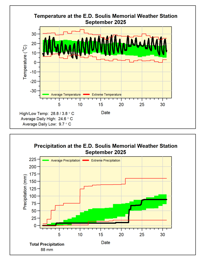
According to the September monthly recap from the E.D. Soulis Memorial Weather Station out of the University of Waterloo, the rain storm from September 21 brought 44.8mm of rain to the region, marking the fourth wettest day for that month in the more than 25-year history of the weather station.
The day saw flooding in streets across Waterloo Region, including on the expressway by the Flyover, in the Weber Street North and Lodge Street area of Waterloo, and on River Road East in Kitchener. Strong gusts brought down trees and power lines that led to power outages.
Before the storm, September was on track to be one of the driest on record, only seeing 10 mm in 20 days.
The total precipitation for the month jumped 88 mm, beating the average of 75.6 mm. The total precipitation for the year has reached 697.8 mm, just slightly above the average of 683.5 mm.

Last month saw the average daily temperature at 24.6 C, marking the third highest for a September in the history of the station.
Notably, there was not a day above 30 C during the month, with the maximum temperature reaching 28.8 C.
The lowest temperature of the month was recorded at 3.8 C, with the average low recorded at 9.7 C.


